
Intelligent Monitoring and Safety Management of Ultra-High Canal Slopes
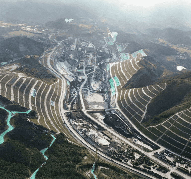
1. A 188-Meter-High Slope: A Major Engineering Challenge
Madao Junction features the highest slopes along the entire canal route. Slope No. 2 reaches a height of 188 meters — 41.41 meters taller than the Great Pyramid of Giza, one of the Seven Wonders of the Ancient World.
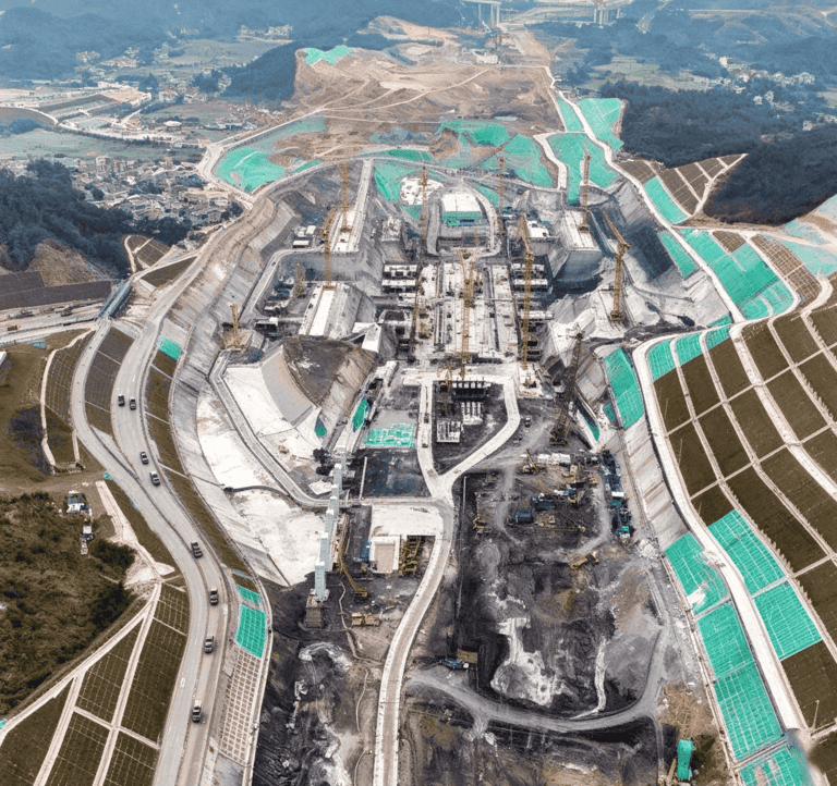
The 188-meter-high canal slope presents significant engineering challenges due to substantial spatial variability in geological conditions. Conventional excavation methods offer limited precision and automation, making it difficult to achieve the smooth, straight slope surfaces required for the quality and appearance of reinforced concrete lattice-beam protection systems.
Key Technology: Intelligent Measurement and Control for High-Precision Excavation of Multi-Level High Canal Slopes
This technology aims to improve excavation accuracy and automation, helping achieve the required slope geometry and surface quality for slope protection works.
2. Intelligent Assessment of Rock Conditions for Ultra-Long Anchor Cables
Five major high-slope protection projects at Madao Junction were completed last year. These slopes feature complex geological conditions, consisting primarily of moderately and highly weathered mudstone and sandstone. A fault fracture zone also extends along the slope toe and crosses the entire hillside.
To stabilize these slopes, anchor cables measuring up to 65 meters in length, each comprising 12 steel strands, extend approximately 15 meters into moderately weathered rock. Each anchor cable can provide a tensile force of approximately 110 tonnes.
However, the anchorage section is buried deep inside the mountain, making its actual embedment depth difficult to determine through external observation alone.
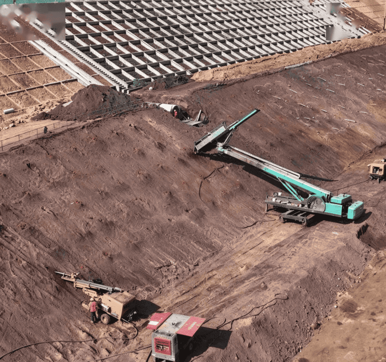
Key Technology: Intelligent Assessment of Anchor Embedment Depth Based on Measurement While Drilling (MWD)
By sensing and analyzing the geological conditions surrounding the borehole during drilling, this technology enables centimeter-level determination of drilling depth and the depth of the anchorage section embedded in rock. This helps verify the required anchorage conditions and ensure the intended load-bearing capacity of ultra-long anchor cables.
3. Intelligent Monitoring of High Slopes in Soft Rock Using NPR Anchor Cables
Landslides are among the most common and serious hazards affecting slopes. Effective monitoring is essential for identifying potential instability early and enabling timely intervention.
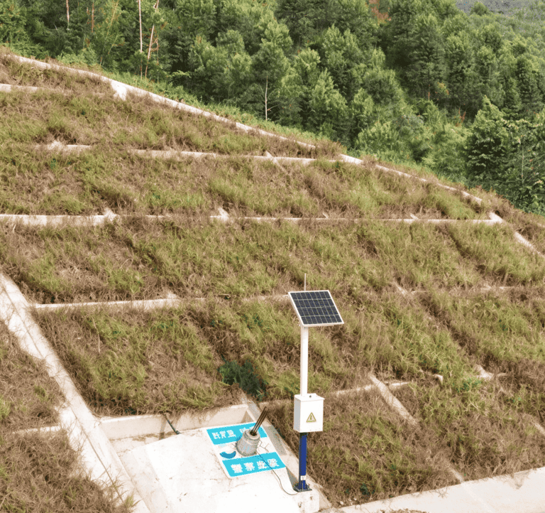
At Madao Junction, an intelligent monitoring and early-warning system was developed based on NPR anchor cables to monitor sliding forces and assess slope stability.
The monitoring system combines multiple methods and monitoring frequencies:
- Surface deformation monitoring: Once per day
- Spatially continuous deformation monitoring: Once every three hours
- Deep-seated displacement monitoring: Once per week
- Groundwater monitoring: Once per week
- Anchor cable and anchor bar axial-force monitoring: Once per week
An early warning is triggered when the horizontal deformation rate of the slope reaches 2 millimeters per day.
By integrating these monitoring methods, the system provides a three-dimensional, comprehensive and continuous assessment of slope conditions, supporting early warning and helping maintain the safety and stability of the canal slopes.
4. From Manual Inspection to Intelligent Slope Monitoring
Landslides can cause severe damage to infrastructure and pose significant safety risks. Early detection of potential instability is therefore critical.
Traditional slope monitoring relies heavily on manual field measurements, which may not provide sufficiently timely or comprehensive information about developing safety risks.
Intelligent monitoring systems combine deformation measurements, deep displacement monitoring, groundwater observations and anchor-force measurements to provide a more complete picture of slope behavior. With appropriate data acquisition, communication and warning mechanisms, monitoring information can be collected, transmitted and analyzed to support earlier risk identification and more informed engineering decisions.
For infrastructure monitoring projects, reliable data acquisition and remote monitoring hardware can help engineers obtain timely field data and improve visibility into slope conditions.
Supporting Slope Monitoring with Reliable Data Acquisition Hardware
Hu Entropy Tech manufactures industrial RTUs, vibrating wire data acquisition units and remote monitoring hardware for geotechnical and infrastructure monitoring applications.
Our hardware supports sensor data acquisition, remote communication and integration with monitoring platforms. Depending on the selected model, available features may include 4G connectivity, multiple communication protocols, edge computing and data storage.
For projects involving slope stability, anchor-force measurement and geotechnical monitoring, our products can serve as hardware components within a broader monitoring system.
Contact us to discuss your data acquisition hardware requirements.